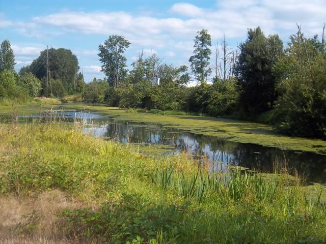
 Strolling the Slough. Click to enlarge |
Curious about this
|
Strolling Along the Slough
This Wilkes East Neighborhood website banner is a slice from a picture taken on a hot August afternoon while strolling the trail along the Columbia Slough adjacent to the northern boundary of the neighborhood. The Columbia Slough is a shallow, slow flowing waterway that parallels the Columbia River for about 18 miles from Fairview Lake in East Multnomah County through North and Northeast Portland to Kelley Point Park where the Slough meets the Willamette River. And now you know.
Columbia Slough Watershed Facts:
- 32,700 acres
- Largest urban wetland in the USA
(Smith and Bybee Lakes Wildlife Area) - Salmon refuge in the Lower Slough
- 175 bird species
- 26 fish species
To learn more visit the Columbia Slough Watershed Council website.
Photo Info
Taken: Sunday, August 14, 2011, Columbia Slough Trail, NE 172nd north of Airport Way.

 Sunrise over Mt Hood. Click to enlarge |
Curious about the
|
Summer Sunrise
This Wilkes East Neighborhood website banner is a slice from a picture of a mid-August sunrise looking east along the Columbia Slough (foreground) at 148th Ave. The sun rises during summer in the northeast (just out of view). Mt Hood in the background, is located about 50 miles (80 km) east-southeast of Portland Oregon and rises 7,706 ft above the Cascade Mountains to 11,249 ft above sea-level. A perfect view to start the day. Don't you agree? And now you know.
About the photo
This picture was actually take August 14, 2010 around 7:30AM regardless of what the date on the picture says (battery change oops) looking east on the bridge over the Columbia Slough at 148th Ave. For more info about the Columbia Slough, Mt Hood and more check-out the links above.

 Fall colors at the park. Click to enlarge |
Curious about this
|
Fall colors abound!
This Wilkes East Neighborhood website banner is a slice from a picture of the bright fall colors in Columbia View Park, a 7.48 acre undeveloped park located at NE 169th & NE Pacific Dr in the southern portion of the Wilkes East Neighborhood. Get Map!
The park is a perfect place for spending time with nature and enjoying the view north across the Columbia River of the beautiful mountain ridges behind Washougal Washington, home to 27 fantastic mountain summits and peaks raising more than 4,000'. And, now you know.
About the photo
The photo was taken late Sunday afternoon November 1, 2009 4:50PM at NE 169th & NE Hassalo St from the northwest edge of Columbia View Park looking southeast.

 Hills across the Columbia. Click to enlarge |
Curious about this
|
A beautiful view indeed
The inaugural Wilkes East Neighborhood website banner is a close-up view of the beautiful mountain ridges behind Washougal Washington, home to 27 fantastic mountain summits and peaks raising more than 4,000'. Looking north across the Columbia River this view can be seen from many locations around the Wilkes East Neighborhood. It's such a familiar sight, we thought it was an appropriate choice. And, now you know.
About the photo
This picture was taken on Mothers Day, May 13, 2007 2:40PM from the HB Lee Middle School athletic field, located on NE 172nd Ave between NE Halsey St and NE Glisan St.


